
Filter Post Type
NewsVideoProductEventLink
Sort:
Most Recent
Tagged:Soil Monitoring
1–1 of 1

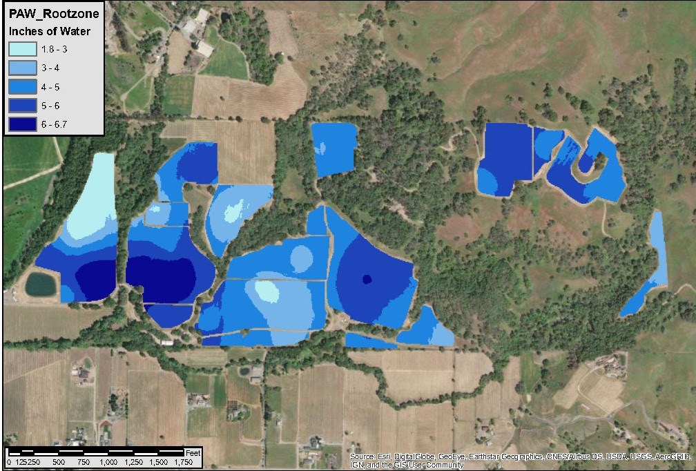
Here at AV we've been working with some new soil-sampling equipment: our power probe and electromagnetic soil electrical conductivity sensor. We've taken data collected via these tools and integrated it with old-fashioned soil pit analysis. The result is a way to spatially view numerous aspects of soils. Check it out! We can use this information to look varying levels of plant-available water in the rootzone. We can also look at differences in organic matter percentage. These are just a few examples of the numerous soil characteristics we can analyze and present. These maps consolidate tables of numerical data into spatial maps that are easily interpreted by anyone - not only soil experts! Read this recent response from one of our clients: "The amount of information is incredible. Very informative for a guy like me who doesn’t know much about the roles of different soil levels. The color map charts clearly show some mass differences throughout
00