In the Wine Industry, precision is key. Whether it's for developing new vineyard sites, expanding existing operations, or managing irrigation systems, having accurate land data is critical. This is where modern surveying technology comes into play.
Ray Carlson & Associates has been at the forefront of using these cutting-edge technologies to provide accurate and efficient land surveys for the North Bay wine industry, including vineyards in Sonoma, Napa, and beyond.
The Role of Drones in Surveying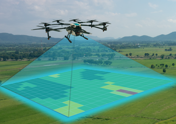
Drones - or unmanned aerial vehicles (UaVs) - have taken land surveying to new heights. With high-definitiion cameras and GPS-enabled flight paths, drones capture precise aerial images that can be stitched together to create detailed topographic maps and 3D models. These models help vineyard owners visualize their land in ways that were once impossible with traditional surveys.
Using drones to map vineyard properties offers several advantages:
- Efficient Coverage: Drones can quickly cover large areas of land that might otherwise be difficult or costly to survey on foot.
- Detailed Aerial Imagery: High-resolution aerial images allow for better visualization of the land's topography, including slopes, water drainage, and potential hazards.
- 3D Modeling: Aerial surveys can generate 3D models of the land, making it easier to plan for new vineyard layouts, irrigation systems, and other infrastructure.
How This Technology Benefits Vineyards
For vineyards, using GPS and drones to survey land is not just about precision - it's about gaining a deeper understanding of the property. Whether you're designing a new vineyard or managing an existing one, accurate data abou tthe land's contours, irrigation systems, and growth potential can make a huge difference.
- Optimal Land Use: With accurate topographic maps, you can decide where to plant grapevines based on the best land conditions.
- Irrigation and Drainage Planning: Knowing the exact slope and contours of your vineyard helps plan an efficient irrigation system, reducing water waste and optimizing vine health.
- Increased Efficiency: Drones make it possible to survey and collect data from hard-to-reach or large areas, reducing the amount of time it takes to get results.
Why Ray Carlson & Associates?
With over 40 years of surveying experience in Sonoma, Napa, and surrounding counties, Ray Carlson & Associates has developed a deep understanding of the land - and the technology used to map it. Our surveys offer unparalleled accurace and efficiency, ensuring that vineyard owners can make the best decisions about their properties.
Contact Ray Carlson & Associates today to see how our surveying can benefit your vineyard.